Thematic maps
Business premises
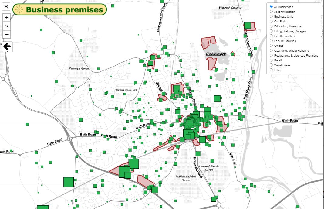
Maidenhead is a commercial town, but what sort of business premises are there? And where are they located?
Using open data from the Valuation Office Agency, the business rates valuation is a reasonable indicator.
The various premises have been plotted by type. The markers show the centre point of each postcode, NOT the exact location of premises. The rateable value does not indicate what the business pays because various adjustments are made.
Pubs, breweries, and maltings
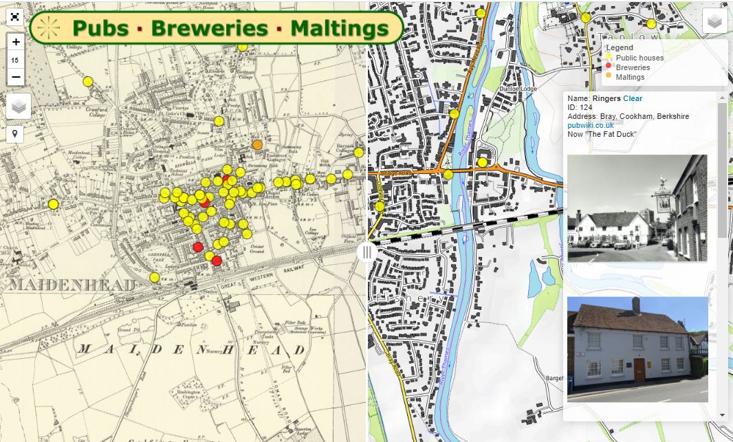
Originally a coaching town on the Bath Road, Maidenhead developed as a linear settlement on drier land near Castle Hill. There was a wide choice of hostelries along the entire “strip” which ran from the Thames crossing to The Folly (now The Windsor Castle) where the Oxford road via Henley originally parted from the Bath road.
They were supported by four breweries and various maltings - and yet-more public houses for the brewery workers set back from the main road. The Nicholson family came to dominate the trade.
There were around 240 public houses across the SL6 area - plotted on this map - although many have been converted to other uses. Photographs, where available, can be viewed in detail – some historical, others contemporary.
Please contact SL6.org.uk with:
- Locations of more pubs, breweries and maltings in the SL6 area
- Additional photographs.


